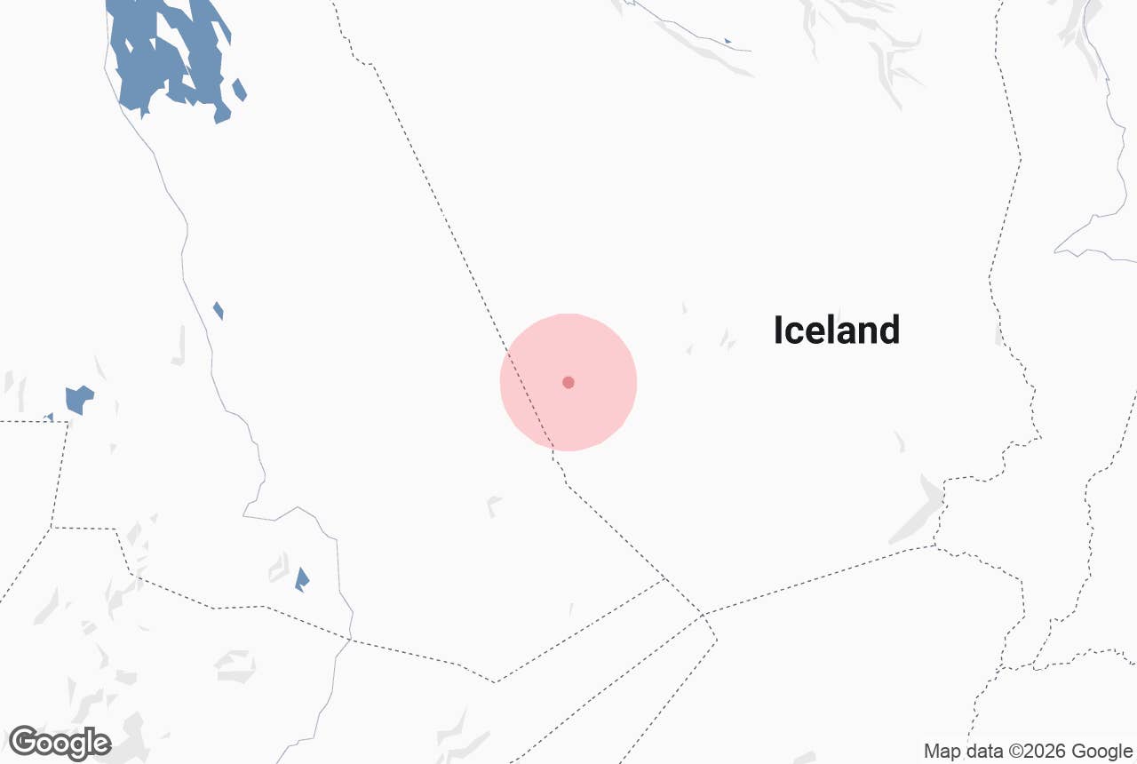
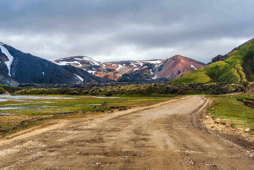
The Icelandic Highlands are a vast volcanic plateau covering the country's interior, home to Landmannalaugar, Thorsmork, and Askja. Reachable only in summer on mountain roads, they are Iceland's greatest wilderness. Read on to plan your visit.
The Icelandic Highlands hold many of the country's most striking natural attractions, spread across a raw interior of rhyolite mountains, glaciers, black deserts, and geothermal oases. The easiest way to experience the region is through Highland tours, such as the popular Landmannalaugar super jeep tour.
The Highlands are surprisingly close to the capital. Landmannalaugar is about 115 miles (185 kilometers) from Reykjavik, a drive of at least 3.5 hours, and the Kerlingarfjoll Mountains are about 124 miles (200 kilometers), or 3.5 hours, away. Thorsmork is around 96 miles (155 kilometers) from Reykjavik, a drive of around 3 hours.
Why You Can Trust Our Content
Guide to Iceland is the most trusted travel platform in Iceland, helping millions of visitors each year. All our content is written and reviewed by local experts who are deeply familiar with Iceland. You can count on us for accurate, up-to-date, and trustworthy travel advice.
Travelers who plan to drive to the Highlands need 4x4 rental cars and a clear understanding of Iceland's F-roads. These mountain roads are only open for a few months per year, typically from June to September. Summer self-drive tours take the route planning off your plate.
The Highland plateau borders almost every region of the country. It rises inland from the South Coast, starts a short hop beyond the Golden Circle, and stretches to the edges of North Iceland. The top places to visit in the Highlands all sit within a day's reach of the Ring Road.
This guide includes insights from Arnar Haukur Rúnarsson, a Highlands expert at the Iceland Touring Association (Ferðafélag Íslands). He guided in Landmannalaugar and on the Laugavegur Trail for three years and later spent four summers as a hut warden in Thorsmork.
Keep reading to prepare for your trip to Iceland's interior.
Key Takeaways
-
The Icelandic Highlands are an uninhabited interior plateau covering about 15,000 square miles (40,000 square kilometers), roughly 40 percent of Iceland.
-
F-roads are open on a rolling basis between early June and mid-July, and close again in September.
-
The Icelandic Highlands see frost in every month except July and August, according to our 26-year temperature study.
-
Landmannalaugar, Thorsmork, Kerlingarfjoll, and Askja are the most visited Highland destinations.
-
The Laugavegur Trail, Iceland's most famous multi-day hike, crosses the southern Highlands over 34 miles (55 kilometers).
-
There are no towns, gas stations, or shops in the Highlands, so every trip needs planning around fuel, food, and weather.
-
Off-road driving is illegal everywhere in Iceland and carries heavy fines.
What Are the Icelandic Highlands
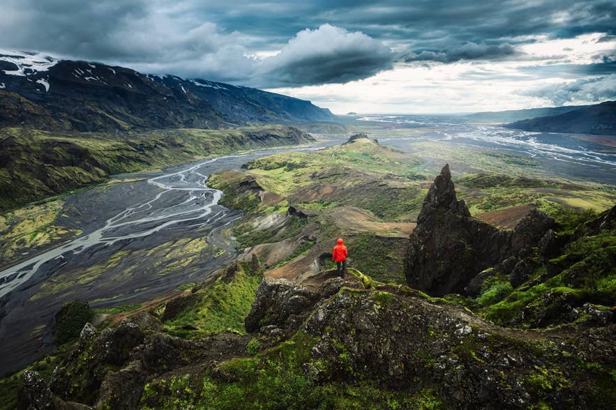
The Icelandic Highlands are the uninhabited volcanic plateau that fills the country's interior. The area covers about 15,000 square miles (40,000 square kilometers) at elevations above roughly 1,300 feet (400 meters). Volcanic ash soils, harsh weather, and months of snow cover have kept the interior empty.
Nearly everything travelers picture when they think of untouched Iceland is here. The plateau holds the country's largest glaciers, its most active volcanoes, vast lava fields and black sand deserts, and green oases fed by geothermal springs. Because there are no settlements, there is also no light pollution and no traffic.
The Highlands are usually described in three broad sections. The most famous is the southern Highlands, home to the colorful rhyolite landscapes of Landmannalaugar and the volcanoes of the South Coast.
Farther into Iceland's interior, the central Highlands are dominated by vast glaciers and the desert crossings between them. The northeastern Highlands, mostly within Vatnajokull National Park, center on the Askja Caldera and the surrounding volcanic landscape.
How To Get to the Icelandic Highlands
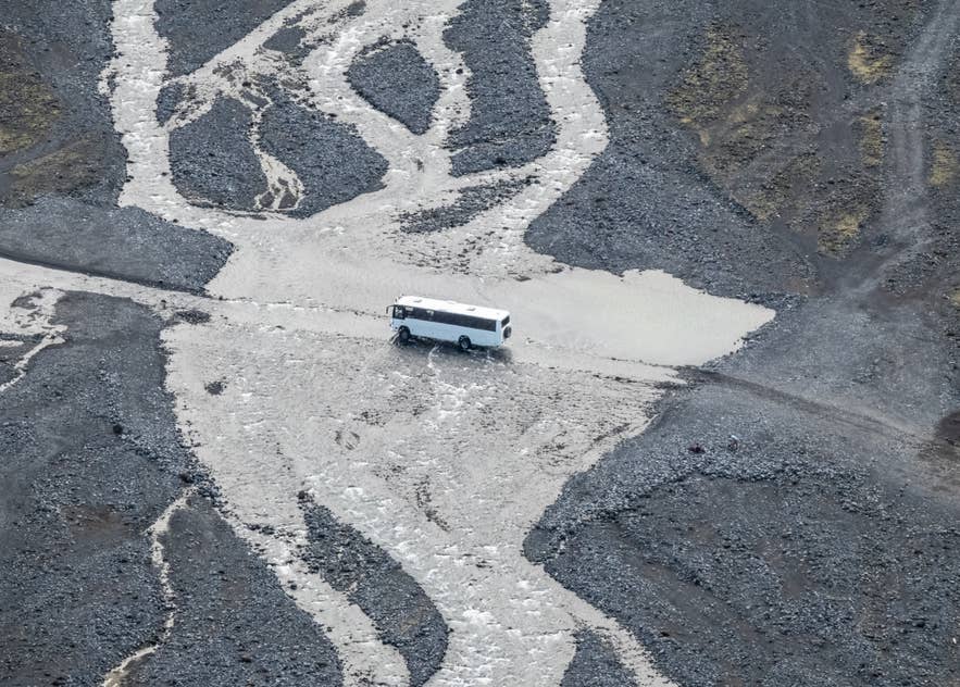
The Icelandic Highlands are reached by F-roads, gravel mountain routes that require a 4x4 vehicle by law and open only in summer. There are three ways in: self-drive tours in rental 4x4 vehicles, Highland guided tours, or getting scheduled Highland bus passes.
Here is how the options compare:
|
Option |
Best for |
What to know |
|
Self-drive with a 4x4 |
Experienced drivers comfortable on Iceland's F-roads |
Requires F-road driving and, on some routes, unbridged river crossings |
|
Guided tour |
First-time Highland visitors |
Super jeep tours and Landmannalaugar day tours handle all driving |
|
Highland bus |
Hikers and budget travelers |
Scheduled summer services connect Reykjavik with Landmannalaugar and Thorsmork |
Renting a regular 2WD car is not an option. Driving one on any F-road is against Icelandic law, and rental insurance is void the moment a 2WD leaves the paved network. River crossings are excluded from standard rental insurance even in a 4x4, so routes with unbridged rivers are better left to super jeeps.
Arnar warns that even renting a 4x4 is not automatically enough for Highland driving.
A 4x4 is not always a proper 4x4 vehicle. The road is rough, and you also need ground clearance."
Arnar cautions that taking an unsuitable vehicle to Landmannalaugar can damage both the car and the road. He suggests careful route planning to avoid the river crossings, including parking before the final ford.
What Are Iceland's F-Roads
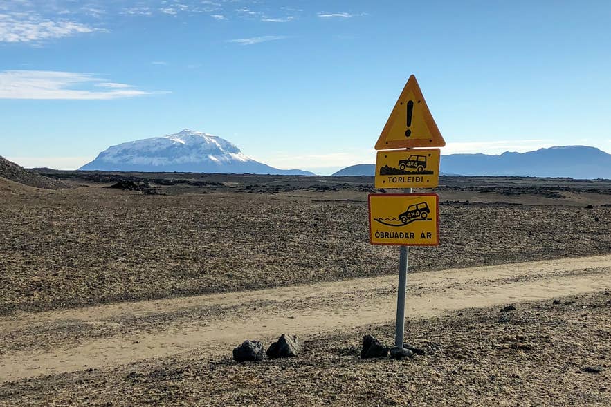
F-roads are Iceland's designated mountain roads, marked with an F before the route number. They are the primary routes into Iceland's Highland interior. The main F-roads include Sprengisandur (F26), which connects South Iceland to North Iceland, and Fjallabak (F208), which connects Route 26 to Landmannalaugar.
F208 approaches Landmannalaugar from two directions. The northern section from Route 26 has no unbridged rivers, while the southern section includes several deep fords.
Other important routes include Kjolur (Route 35), which connects Gullfoss to North Iceland, and Kaldidalur (Route 550), which runs from Thingvellir toward West Iceland. Both lost their F prefix after road improvements but remain unpaved summer-only mountain roads, and rental agreements still require a 4x4 to drive them.
Opening dates vary each year with the spring thaw, and the Icelandic Road Administration announces each road's opening after inspection. Always check the official road conditions site before any Highland drive. Roads usually close again in September as snow returns.
Best Places To Visit in the Icelandic Highlands
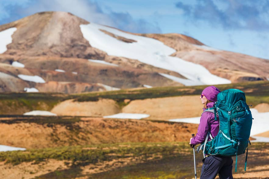
The best-known places to visit in the Icelandic Highlands are Landmannalaugar, Thorsmork, Kerlingarfjoll, and Askja, each reachable as a long day trip or an overnight stop in summer. Together, they cover the full range of Highland scenery, and each one has its own approach road and character.
Landmannalaugar and the Southern Highlands
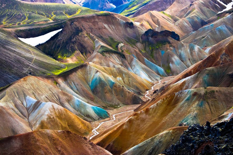
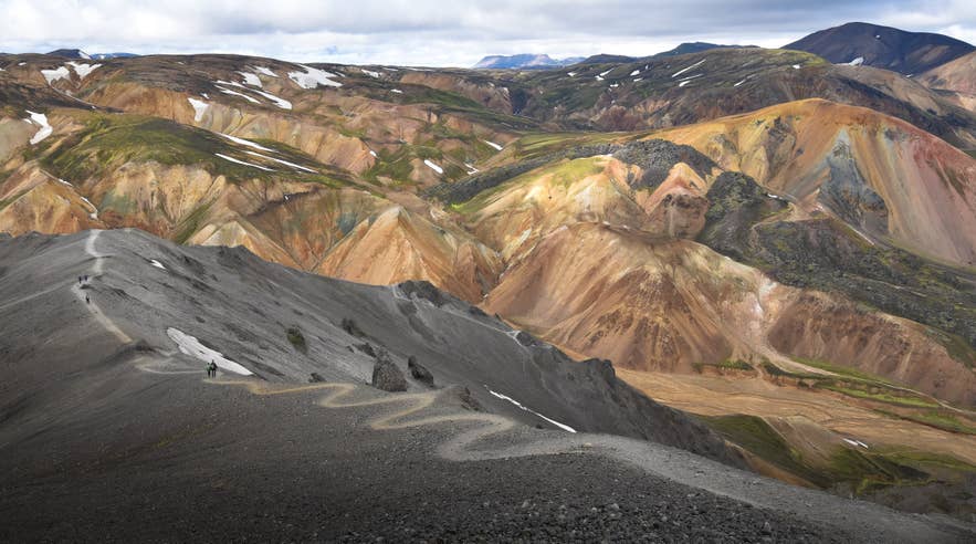
Landmannalaugar is the most popular destination in the Highlands, famous for rhyolite mountains streaked in red, gold, and green, and for the natural hot spring where hikers soak after a day on the trails. It sits in the Fjallabak area at the head of the F208, about 115 miles (185 kilometers) from Reykjavik.
For visitors with only one day in the area, Arnar recommends the classic circuit through Graenagil and the Laugahraun lava field to Brennisteinsalda, the colorful mountain most people recognize from photos of the area. Climbing Blahnukur, he adds, gives you the best view of Brennisteinsalda itself.
The wider southern Highlands reward detours. Haifoss Waterfall plunges off the plateau edge near the Thjorsardalur Valley, and the Sigoldugljufur Canyon, lined with spring-fed waterfalls, lies just off the road to Landmannalaugar.
Thorsmork Valley
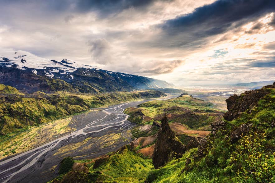
Thorsmork is a green glacial valley wedged between three glaciers on the southern edge of the Highlands, and it is the finishing point of the Laugavegur Trail. Birch woodland, braided rivers, and ridge-top viewpoints make it the most vegetated place in the Highland region.
The glaciers even give the valley its own weather, according to Arnar.
Weather tends to stick around in the glaciers, leaving a pocket of clear skies above Thorsmork. You'll often be driving in rain right until you get to Thorsmork."
The approach road, the F249, includes some of Iceland's most serious river crossings, and many rental cars have been damaged while attempting to cross the Krossa River. Most visitors arrive by Highland bus or guided super jeep rather than driving themselves.
Day-trippers usually get off the bus at Husadalur, hike to the top of Valahnukur, and get picked up below in Langidalur. Arnar rates the view from Valahnukur among the best in Thorsmork, but suggests flipping the plan: start at Langidalur instead and walk the Tindafjallahringur loop, which has a fine viewpoint of its own and takes in more of the valley along the way.
Kerlingarfjoll and Hveravellir on the Kjolur Route
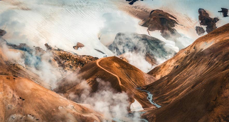
The Kerlingarfjoll Mountains are a cluster of steaming rhyolite peaks off the F35, about 124 miles (200 kilometers) from Reykjavik. The Hveradalir Geothermal Area, where hot vents hiss between orange slopes, is one of the most photographed landscapes in Iceland, and the site has one of the few staffed lodgings in the Highlands.
Further north on the same route, the Hveravellir Nature Reserve is a geothermal oasis between the Langjokull and Hofsjokull Glaciers with a bathing pool beside the huts. The Kjolur Route as a whole is the gentlest introduction to Highland driving, with bridges over its rivers.
Askja and the Northeast Highlands
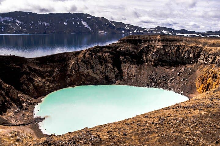
The Askja Caldera is the highlight of the northeastern Highlands, home to Oskjuvatn, one of Iceland's deepest lakes, and the milky-blue Viti Crater. A massive eruption in 1875 blanketed eastern Iceland in ash, and Apollo astronauts trained here in the 1960s because the landscape resembled the moon.
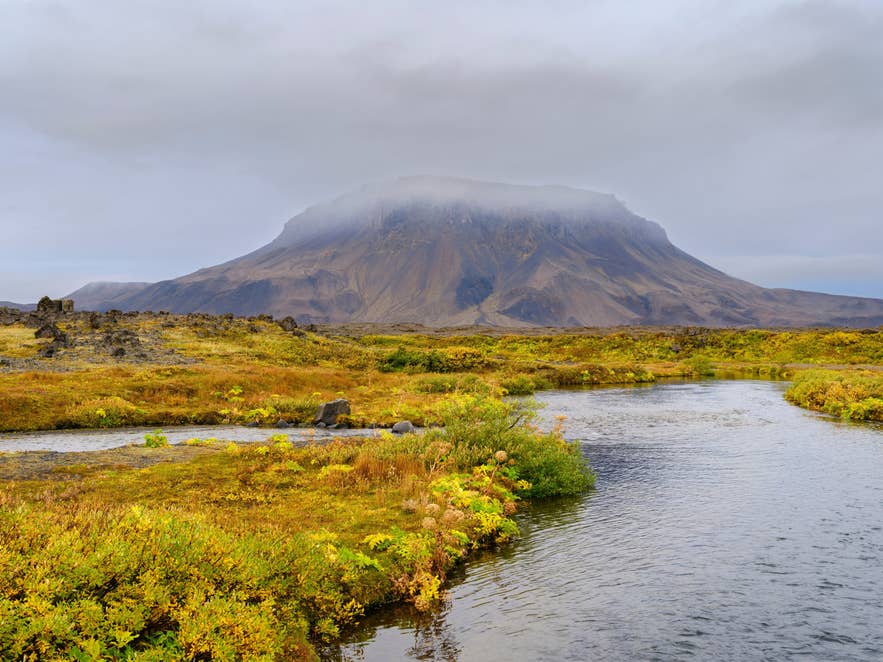
Askja lies about 143 miles (230 kilometers) from Akureyri, and most visitors base themselves at Lake Myvatn before exploring the area. On the way in, the flat-topped Herdubreid Mountain rises alone from the desert.
The Northeast Highlands are the driest corner of Iceland, according to our study of the rainiest month in Iceland. Rain still falls on 12 to 16 days a month at Grimsstadir, mostly in small amounts, so pack the waterproofs anyway.
At the plateau's northern edge, the Aldeyjarfoss Waterfall drops between black basalt columns at the top of the Sprengisandur Route, and Dettifoss Waterfall, often called Europe's most powerful waterfall, thunders a short drive beyond the Highland boundary.
Hiking in the Icelandic Highlands
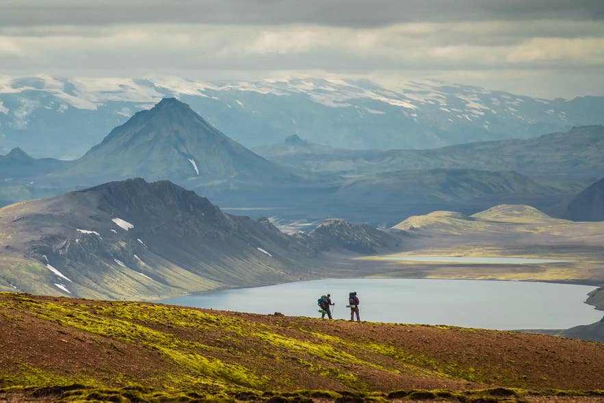
The Icelandic Highlands are the country's best hiking territory, and the 34-mile (55-kilometer) Laugavegur Trail between Landmannalaugar and Thorsmork is Iceland's most famous multi-day route. Most hikers walk it in four days, sleeping in mountain huts or campsites along the way, and huts should be booked well in advance.
July and August are also the calmest months on exposed Highland trails, according to our study of the windiest and least windy months in Iceland. Wind closures are least likely then.
Although the Laugavegur Trail is popular, Arnar says hikers can often avoid the main flow of traffic by starting earlier or later than most groups. Iceland Touring Association, which runs the huts along the route, launched an online booking system for huts and campsites, which makes it easier to see which days will be busier than others.
Day hikers have plenty of options too. Landmannalaugar's loop trails climb Brennisteinsalda and Blahnjukur in a few hours, Hveradalir at Kerlingarfjoll has boardwalks through steaming geothermal fields, and Thorsmork offers trails ranging from easy woodland walks to the steep climb up Fimmvorduhals Pass.
Wherever you go hiking in Iceland, stay on marked trails. Walking on Icelandic moss or fragile soil causes damage that can take decades to recover. If you want to explore the Highlands without planning routes or navigating remote terrain, guided hikes are available for all experience levels.
Recommended Highland Tours
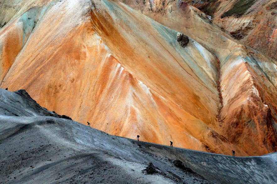
Whether you want to explore the Highlands on a day trip or spend several days hiking through Iceland's wilderness, these guided tours cover some of the region's most spectacular landscapes.
-
5-Day Landmannalaugar to Thorsmork Hiking Tour: Follow the famous Laugavegur Trail from Landmannalaugar to Thorsmork with an expert guide, mountain hut accommodation, luggage transfers, and meals included.
-
Thorsmork Hiking Tour: Explore the Thorsmork Nature Reserve on a guided day hike with Super Jeep transportation into the valley, visiting one of Iceland's most scenic hiking areas.
-
Landmannalaugar Bus Tour with Hiking & Nature Baths: Travel by Highland bus from Reykjavik to Landmannalaugar, stop at Hjalparfoss, Haifoss, and Hnausapollur Crater, enjoy a guided hike through the colorful rhyolite mountains, and finish with a soak in the natural hot spring.
-
6-Day Laugavegur & Fimmvorduhals Hiking Tour: Hike both the Laugavegur Trail and the Fimmvorduhals Pass with an experienced guide, staying in mountain huts while luggage transfers and meals are provided.
-
Landmannalaugar Super Jeep Tour: Travel into the Highlands by Super Jeep to hike in Landmannalaugar, soak in its natural hot spring, and visit Thjorsardalur Valley, Hjalparfoss, Hnausapollur, Frostastadavatn, Ljotipollur, and Haifoss along the way.
Places To Stay in the Icelandic Highlands
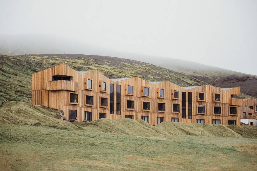
Places to stay in the Icelandic Highlands come down to four options: mountain huts, campsites, the hotel at Kerlingarfjoll, and guesthouses on the edges of the plateau. There are no towns in the interior, so every overnight needs to be booked or planned before you drive in.
Mountain huts are the classic Highland stay. The Iceland Touring Association runs the huts along the Laugavegur Trail and at Landmannalaugar, and its online booking system shows availability for every hut and campsite on the route. Summer beds sell out months ahead.
Camping is the budget option, with campsites at all the major destinations, including Landmannalaugar, Thorsmork, Hveravellir, and Kerlingarfjoll. Camping outside marked campsites is illegal, and campervans and rooftop tents must use registered campsites. The full rules are covered in this guide to camping in Iceland.
For more comfort, Highland Base at Kerlingarfjoll is the only hotel deep in the interior, with hotel rooms, hostel-style huts, and a campground. On the edges of the plateau, the Highland Center Hrauneyjar is the last guesthouse and fuel stop before Landmannalaugar, while Myvatn hotels serve as the main base for visiting Askja.
Volcanoes and Glaciers of the Highlands
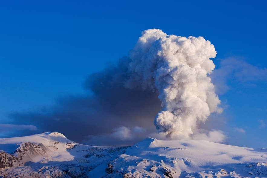
The Icelandic Highlands contain the country's three largest glaciers and most of its active volcanoes, which together have shaped the interior over thousands of years. Vatnajokull, Europe's largest glacier by volume, covers about 2,970 square miles (7,700 square kilometers) of the southeast plateau.
Iceland's highest peak, Hvannadalshnukur, rises to 6,921 feet (2,110 meters) on the Oraefajokull Volcano at Vatnajokull's southern edge. Langjokull and Hofsjokull fill the central Highlands, and all three glaciers are profiled in this guide to Iceland's glaciers.
The Highlands are just as defined by volcanoes as they are by ice. Hekla, one of Iceland's most active volcanoes, guards the southwestern approach to the interior, while Katla lies beneath the nearby Myrdalsjokull Glacier.
Eyjafjallajokull became world-famous after its 2010 eruption grounded air traffic across Europe, earning the nickname "E15." Southwest of Vatnajokull, the Lakagigar Crater Row marks the 1783 Laki eruption, while Grimsvotn beneath the glacier remains one of Iceland's most active volcanoes.
Wildlife and Highland Oases
The Icelandic Highlands shelter rare pockets of life between the deserts, and the most important is Thjorsarver, a wetland south of Hofsjokull. It was designated a Ramsar site in 1990 and was long the world's largest known breeding ground of the pink-footed goose.
Other oases, such as Herdubreidarlindir beneath Herdubreid Mountain, support springs, moss, and birdlife in the middle of the lava.
Wild reindeer roam the eastern edge of the plateau and down into East Iceland, the only part of the country where they live. They were brought from Norway in the late 18th century, and the herds have run free ever since.
Safety in the Icelandic Highlands
Highland travel demands careful preparation because help can be hours away and conditions change quickly. Distances are long, there is no fuel between the edges of the plateau, and mountain weather can turn wintry in any month.
Follow these rules on every Highland trip:
-
Leave a travel plan with SafeTravel, Iceland's official safety site, before setting out, and remember that 112 is the emergency number.
-
Check road status on the Icelandic Road Administration site and the forecast from the Icelandic Met Office every morning.
-
Never drive off marked roads. Off-road driving is illegal everywhere in Iceland, carries heavy fines, and scars the landscape for decades.
-
Avoid routes with river crossings if you are unfamiliar with Highland driving.
-
Fill the tank before leaving the lowlands, and carry food, warm layers, and a paper map as backup.
Guided tours remove most of these risks at once, which is why first-time Highland visitors usually start with one.
When To Visit the Icelandic Highlands
The Icelandic Highlands are open from roughly mid-June to September, the window between the spring road openings and the first autumn snow. July and August are the most reliable months, with routes open, the huts staffed, and the Highland buses running.
June is the sunniest month across the north and the interior, according to our study of the sunniest month in Iceland. It is also a frost month. Grimsstadir, a remote farm east of Lake Myvatn, averages about two frost nights in June and about five in September, and none in July or August.
Outside summer, the interior effectively closes. The F-roads are snowed over or impassable in winter. Shoulder-season travelers should build their Highland days around the official road opening announcements rather than fixed dates.
Plan Your Visit to the Icelandic Highlands
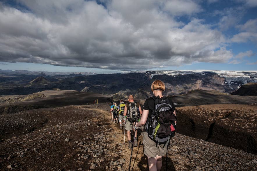
The Icelandic Highlands reward careful planning with some of the country's most dramatic landscapes and quietest places. A Landmannalaugar hiking and nature baths tour is a great introduction for first-time visitors, while a Landmannalaugar Super Jeep tour lets you experience the interior without tackling F-roads yourself.
If hiking is your priority, the 5-day Landmannalaugar to Thorsmork hiking tour follows Iceland's most famous trail with expert guides and mountain hut accommodation. Travelers with more time can also choose the 6-day Laugavegur and Fimmvorduhals trek for an even longer hiking adventure.
Experienced drivers can explore at their own pace on a 7-day Iceland self-drive tour with Highland stops. Whichever option you choose, book accommodation well in advance and check road and weather conditions before setting out.
