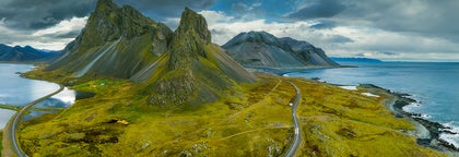
Highlights: 
West Iceland is home to the country’s capital city, Reykjavík, and an array of impressive natural sites. These include Europe's most powerful hot spring, Iceland's most significant lava tube, fascinating glaciers, beautiful waterfalls important historical sites and more. It has three main districts outside of the capital area: Borgarfjörður, the Snӕfellsnes Peninsula, and Breiðafjörður.
Though also in the west, the Westfjords and Reykjanes Peninsula are considered to be in separate regions.
The Capital Area
Iceland’s capital city is Reykjavík, a settlement of 120,000 people (over 200,000 in the Greater Reykjavík Area) that was founded in 870 AD by Ingólfur Arnarson; this makes it the country’s oldest inhabited area.
It is a hot spot of culture, with festivals such as Sónar, Airwaves and Secret Solstice, events such as Pride and Culture Nights, and countless museums and galleries. The city is also renowned for its vibrant live music, cabaret and drag scenes, its street art, many sculptures, and its delicious cuisine.
Its architecture is particularly of note, with impressive buildings such as Hallgrímskirkja Church and the Harpa Concert Hall.
Reykjavík is where most visitors base themselves and the point from which most tour leaves. There is a comprehensive guide to Reykjavík on this site.
Borgarfjörður
Borgarfjörður is the fjord north of Reykjavík, within which is a wealth of beautiful historical and natural sites. Reykholt, for example, is a tiny village where medieval historian and poet Snorri Sturluson, author of Snorra-Edda and Heimskringla, once lived. Borgarnes, the main village of Borgarfjörður, is one of Iceland’s earliest towns, and home to the fascinating Settlement Centre.
In terms of nature, Borgarfjörður is home to the second highest waterfall in the country, Glymur. Other beautiful waterfalls include the magical and peaceful Hraunfossar and the raging rapids of Barnafoss which lie only a stone's throw apart. The area is also home to the longest lava cave in the country, Viðgelmir, the highest flowing hot spring in Europe, Deildartunghver, and just inland is Iceland’s second biggest glacier, Langjökull.
Snӕfellsnes
The Snӕfellsnes peninsula is a marvellous stretch of land in west Iceland. It is home to a unique mountain ridge with the majestic Snӕfellsjokull glacier and National Park at its westernmost point.
The region is often called Iceland in miniature due to its diverse sites, which include beautiful mountains such as Kirkjufell, geological wonders such as the Gerðuberg cliffs, and coastal formations such as Lóndrangar rock pinnacles.
Breiðafjörður
Breiðafjörður is the fjord that separates the Westfjords from the Snӕfellsnes Peninsula. It is a natural reserve with countless small islands and home to thousands of birds, including puffins.
The inner part of Breiðafjörður is the old farm site Eiriksstadir, the home of Eric the Red, the first European to land in Greenland, in the year 984 AD. His son was Leif Ericsson, the first European to land in America, in the year 1000.
West Iceland , 
Hraunfossar ('Lava Falls' in English) in Borgarfjörður district is a series of beautiful waterfalls formed by rivulets streaming out of the Hallmundarhraun lava field. It is located in West Iceland near another waterfall called Barnafoss.
Geography and Surroundings of Hraunfossar
The lava field that Hraunfossar trickles through flowed from an eruption of one of the volcanoes lying under the nearby glacier of Langjökull, the second largest ice-cap in Iceland. The waterfalls pour into the Hvítá river from ledges of less porous rock in the lava.
The Hvítá river is one of the most popular rivers amongst visitors for two reasons. Firstly, it is the most easily accessible rafting river from Reykjavík, with rapids that are manageable even for total novices. Secondly, it is the river that hosts the mighty waterfall Gullfoss, one of the three sites of the popular the Golden Circle route.

Because the area around Hraunfossar used to be the site of constant eruptions, the lava fields are known for their hidden caves. The country's longest cave, Víðgelmir, can be found near the waterfall. This amazing feature is 1,595 metres long (5,200 feet), up to 15.8 metres high (52 feet) and 16.5 metres wide (54 feet).
Its geological history may be fascinating, being just a thousand years old, though its human history stirs just as much intrigue as the lava field was once home to bandits and, according to folklore it is the home of trolls.
Another major site near Hraunfossar is an incredibly short walk away, and though also a waterfall, could not be more different. Barnafoss surges down a narrow, rocky valley with ferocious power, foaming and churning quite spectacularly. According to legend, however, the force of these rapids led to tragedy.
It was said that an old stone bridge once went over the falls, and two boys at a nearby farm, bored at home, attempted to cross it to catch up with their parents at church. However, they felt dizzy due to its height, fell, and drowned.
The legend ends in two different ways, with the least interesting saying the mother in grief simply ordered the bridge destroyed. Other tales say that she cursed the bridge using an Icelandic rune so that any who crossed would meet the same fate as her sons.
In this version, the bridge and curse were later broken by an earthquake.
The story led the waterfall its name; it translates to ‘Children’s Falls’.
Settlements near Hraunfossar
The nearest settlement of significance to Hraunfossar is Reykholt.
This tiny village has a huge history, being home to the legendary writer, chieftain, lawspeaker and poet Snorri Sturluson. Without Snorri, huge amounts of Icelandic, Nordic and even British history would be unknown.
He alone at the time catalogued a history of Norwegian kings and their relations with other monarchs through the work Heimskringla, as well as the Norse mythological beliefs through Prose Edda. It is also believed that Snorri first wrote many of the sagas still read today.
Reykholt has a centre dedicated to Snorri called Snorrastofa, which discusses his fascinating life as much as his works. Working during the times of Iceland’s tumultuous civil war as a chieftain, lawspeaker and spokesman of the Norwegian king, who had ambitions to take the country, it is a story with as much politics, betrayal, blood and sexual impropriety as Game of Thrones.
Hraunfossar is also reasonably close to Borganes, another town with a long history. Here, visitors can see the Settlement Centre with its two exhibitions on Iceland’s past, one is on the first people to reach this island over a thousand years ago, and the other is on Iceland’s most famous saga, Egil’s Saga.
Hraunfossar,

Deildartunguhver is a hot spring located in Reykholtsdalur, a district of west Iceland. Deildartunguhver is the highest flowing hot spring in Europe and is widely known for its rapid flow rate of 180 litres (380 pints) per second.
Geothermal activity at Deildartunguhver
Reykholtsdalur is one of Iceland’s most popular places to see hot springs, along with the Geysir Geothermal Area, the Highlands, the Reykjanes Peninsula, Reykjadalur Valley and Námaskarð Pass. While each of these areas have their appeal, at no other does the water rise with such ferocity.
The water at Deildartunguhver hot spring emerges at a constant 97 degrees Celsius (207 degrees Fahrenheit), making it incredibly dangerous for those who venture too close. Thankfully, there are a number of wooden walkways and observation points that lead you around the hot springs without putting you at any risk.
Due to the sheer energy bubbling under Deildartunguhver, much of the water is used for heating Icelandic homes. One pipe travels 34 kilometres (21 miles) to Borgarnes, whilst another travels 64 kilometres (40 miles) to Akranes.
This means that if you’ve taken a shower or bath within a 64-kilometre radius of Deildartunguhver, you will have touched the water from the hot spring.
All Icelandic hot water comes from hot springs such as this, except in some parts of the Westfjords which are now geologically much older than the rest of the country, and thus less active.
This is a fantastic example of how Icelanders efficiently use the geothermal energy provided and is one of the major reasons as to why Iceland has such an excellent reputation for green energy.
Points of Interest at Deildartunguhver

Whilst in the area, many visitors choose to make a stop at Krauma Geothermal Bath & Spa, a fantastic and relaxing complex that makes for a cheaper, more isolated alternative to the Blue Lagoon.
Visitors to Kraua will experience the hot water of Deildartunguhver blended perfectly with glacial water from Iceland’s smallest ice cap, Ok (which rhymes with ‘talk’), creating the perfect bathing temperature.
Krauma has a total of six pools, a relaxation room and two steam baths.
Visitors to Deildartunguhver with an interest in botany will also be able to check out the Blechnum Spicant, aka; “deer fern”, a type of plant that grows nowhere else in Iceland.
Surroundings of Deildartunguhver
Deildartunguhver is located in west Iceland. The two most notable points of interest nearby are two waterfalls, Hraunfossar and Barnafoss.
Hraunfossar, or the ‘Lava Falls’, is, in fact, a series of tiny cascades that trickle through an old lava field. Barnafoss, or ‘the Children’s Falls’, is a more powerful rapid, steeped in a dark legend.
Deildartunghver is also near Víðgelmir, the longest lava cave in the country, trailing for 1,595 metres (5,200 feet) beneath the surface of the earth.
The most significant settlement near Deildartunghver is Reykholt, a beautiful village with a fascinating history. This settlement was once home to Snorri Sturluson, a historian, writer, chieftain and poet without whom we would know very little of the Nordic mythology, folklore and history at the time.
His works, and life--full of politics, betrayal, affairs and war--can be learnt about in the town at the Snorrastofa Centre.
Deildartunguhver, 
Hvalfjörður is a fjord in southwest Iceland. The fjord is approximately 30 kilometres (19 miles) long and five (three miles) kilometres wide.
Nature and Landscape
The landscape of Hvalfjörður is varied and beautiful, with wide areas of flat land along majestic mountains, green vegetation in summer and beaches cut with creeks.
The area is rich in bird life and is home to seals, but despite its name, which translates to ‘Whale Fjord,’ it is not known for its whale or dolphin populations. Two theories exist on how it got its name; either that it was once home to whales before fish stocks moved away, or because of the general shape of the bay.
The area has recently been part of Iceland’s successful reforestation effort.
Natural attractions in the area are plentiful but most significant is Iceland's highest waterfall, Glymur, in the river Botnsá. There are also plenty of interesting hiking trails in the area, such as Síldarmannagotur, leading north, and Leggjabrjótur, leading east towards the area of Þingvellir National Park.
History and Culture
Historically, Hvalfjörður was home to one of the main whaling stations in Iceland, with ships heading out into Faxaflói Bay. It was one of the most important naval stations in the North Atlantic during World War Two, when Iceland was occupied by the Allies after the Nazis conquered Denmark.
The old whaling station and a war museum can be found in the fjord.
Iceland's main psalm poet, Hallgrímur Pétursson, writer of the ‘Passia Hymns,' lived in Hvalfjörður. The area was also the home of the late Sveinbjörn Beinteinsson, poet and performer and head of the Icelandic Pagan Association.
Economy
Most inhabitants of the fjord live in rural areas, and there is some farming in the area. Until the 1990s those travelling between Borgarnes and Reykjavík had to take a long detour around the fjord, but this was solved with a tunnel that travels beneath it, finished in 1998.
Grundartangi promontory in Hvalfjörður has one of the largest harbours in the country and two industrial plants. One is a ferrosilicon plant, operated since 1979, the other an aluminium smelter, operated since 1998.
Both of these were controversial during their construction, and continue to be controversial during their ongoing operation. Along with whaling and hydroelectric dams, smelters and silicone plants are the hottest environmental debates going on in Iceland.
Hvalfjörður, 
Borgarfjörður is a fjord and a district in south western Iceland, by Faxaflói bay. It covers the coastal land between Reykjavík and the Snӕfellsnes Peninsula.
Economy, History & Culture
Though mostly rural, several townships are in the fjord, the largest being the town Borgarnes, with a population of around 1763 people. This is a commerce and service centre for a large part of the southwest. Of particular note here for travellers are the Settlement Centre and the Centre for Puppet Art.
Another town, Hvanneyri has an Agricultural University and a museum showing the developing of Icelandic farming. The latter building also has an interesting handicraft centre.
Reykholt, though small in size, is one of the most historically important places in the country and hosts a centre for medieval studies, Snorrastofa.
Snorrastofa is named after writer and chieftain Snorri Sturluson, author of Snorra-Edda and Heimskringla. Snorri's Edda is the most important historical source we have about the Norse Gods and the history of Scandinavia.
Among the many who have found inspiration in it are author J.R.R. Tolkien (most famous for The Lord of the Rings), G. R. Martin (most famous for Song of Fire and Ice) and composer Richard Wagner with his four operas collectively named Der Ring des Nibelungen.
Nature
Hvíta river runs through the fjord, but should not be confused with the popular rafting river of the same name. This hold the beautiful Hraunfossar waterfalls, which trickle in rivulets out of the Hallmundarhraun lava field. Near here is another famous waterfall, Barnafoss.
Many of the other rivers in the area are very popular for salmon fishing.
The mountains of the district are highly scenic and varied, lending further beauty to the area. Many rare minerals have been found here, giving some a beautiful, distinctive colouration. There is still volcanic activity in a few of these mountains, best noted at Deildartunghver, the highest flowing hot spring in Europe.
Other nature activities that can be enjoyed are horseback riding and lava caving. Riding is popular throughout the area, though caving is best at Viðgelmir, the longest lava cave in Iceland.
Borgarfjörður,
Húsafell is a large farm and church site in the Borgarfjörður district of West Iceland. With incredible natural beauty, it has been a popular resting spot for travellers since the earliest days of the country.
History of Húsafell
Húsafell is quite inland for an Icelandic settlement, made possible due to the fertile lands and relative lack of eruptions in the area. In spite of its distance from the coast, fishing has always been popular due to the trout lakes and salmon rivers within it.
A rectory once stood on the farm, gaining it fame as a location across the country when it was in its deepest religious throes, although all that remains now is a church.
The settlement was also well known for being somewhat of an oasis for weary travellers. Those travelling from regions such as the north, the Westfjords, and the Snæfellsnes Peninsula, on their way to and from Reykjavík or Þingvellir National Park, would often find that this was one of the very few places en route they could comfortably find refuge and food.
Due to Iceland’s harsh conditions, it became very taboo to turn down a houseguest, although to counter this, due to its scarcity of resources it was also taboo to stay longer than three days.
Húsafell gained a new reputation in the 19th Century when a colony of artists, including Jóhannes S. Kjarval, perhaps the country’s most important painter, lived and worked there. It has continued this tradition for art, with sculptor and musician Páll Guðmundsson being its most famous current resident.
Guðmundsson is best known for his carvings of stone faces, and for the stone harps he has created. He has played these alongside the internationally acclaimed Icelandic band, Sigur Ros.
Services and Features of Húsafell
Today, Húsafell is most popular and well-known as a camping location. There are many campsites, cabins, bungalows and holiday homes to be rented in the area, making it very popular amongst both locals and travellers. The old farmhouse, dating back to 1904, is also now a hotel.
Hiking is very popular, due to the beautiful birch forest of Húsafellsskógur; due to the fact that Húsafell is reasonably sheltered, the trees here can reach four metres (13 feet) tall, which is unusual in Iceland. Because of the force of the wind, Icelandic birch tends to form more like a gnarled bush.
This forest grows from a lava field, where geothermal pools can be found.
The dramatic mountain Tengil also provides many hiking opportunities; it was this mountain that named the area, with ‘húsa’ meaning home and ‘fell’ meaning ‘mountain’.
Húsafell is also blessed with its proximity to many incredible natural features of Iceland. Two of the most significant of these are the waterfalls Hraunfossar and Barnafoss, which are located right beside each other. Hraunfossar trickles in many tiny streams from a wide plateau of jagged lava rock, while Barnafoss rushes down a narrow valley with daunting force.
The highest flowing hot spring in Europe, Deildartunghver, is also found nearby.
For those seeking to explore the Snæfellsnes Peninsula or Westfjords, Húsafell provides a great location to spend the night before, putting you closer to both locations.
Húsafell,
Barnafoss is a rapid waterfall in West Iceland, just a short walk away from the serene Hraunfossar falls. It is best known for its dark history in folklore, and for how much it contrasts with its neighbour.
Folklore of Barnafoss
Barnafoss translates to ‘the Children’s Falls’ because of a legend long told about it. Back in Iceland’s early days, it was said that a family with two boys lived at the nearby farm of Hraunsás. The parents left home for church one morning, ordering the young ones to remain at home, but with nothing to entertain them, the children soon decided to follow.
They knew a shortcut to the church: a stone bridge, arching over the nearby rapid waterfall, that back then would have had a different name. They started to cross it, but found the heights and surging water below dizzying. In a tragic turn of events, neither boy made it across the bridge, and both fell to their deaths.
Though both parents were grief-stricken, the mother veered towards insanity. Some versions of the tale end with her demanding the bridge be torn down. Others say she turned to witchcraft, placing a rune on the bridge that made any who crossed it plummet to their deaths just like her beloved sons.
If the latter version is true, her spell was broken when an earthquake shattered the passage.
While Iceland’s tales of magic were, of course, exaggerated as they were passed down in oral tradition, it is very possible that this story is true; Barnafoss would kill whoever fell into it in all likelihood, and many Icelanders scratched runes to spread curses to their neighbours and rivals.
It is, of course, equally possible that like many Icelandic tales, it was simply created as a way to ensure that young children respected their parents, and feared the country’s unpredictable nature.

Surroundings of Barnafoss
Barnafoss is a magical site in and of itself, twisting, turning, foaming and churning as it races down a narrow valley, from which you can view it from above. It is even more fantastical, however, due to its contrast with Hraunfossar.
Rather than being a narrow rapids, Hraunfossar is a wide series of trickling waterfalls, flowing from a plateau of lava rock. Seeing the drama of one, followed by the peace of the other, is an excellent example of how Iceland’s scenery is ever-changing, and completely different spectacles can exist within mere metres of each other.
Other sites of the west near Barnafoss include the highest-flowing hot spring in Europe, Deildartunguhver, which is fascinating to admire but impossible to bathe in due to its extreme heat.
There are also the settlements of Reykholt and Borgarnes, both of which should be visited by those passionate about Icelandic history and culture. Reykholt hosts the Snorrastofa Exhibition, where you can learn about the village’s most famous resident, Snorri Sturluson. Snorri wrote many of the Icelandic texts that reveal huge amounts about Nordic kings, Norse mythology, and Icelandic folklore.
Borgarnes, meanwhile, has the Settlement Centre, where guests can learn about the brave first arrivals to this stark new home, and one of the country’s most famous sagas, Egil’s Saga.
Barnafoss,
The mighty Langjökull, the ‘Long Glacier’, is the second-largest glacier in Iceland, at 935 square kilometres (361 square miles). For jeep and snowmobile trips, Langjökull is the most popular glacier in Iceland, and skiing and hiking here is possible as well.
Highland tracks

Langjökull is located in the Highlands, and two main highland tracks, connecting the north and the south of Iceland, lie alongside it.
The Kaldidalur road stretches from Þingvellir National Park northwards to Húsafell. The Kjalvegur road, meanwhile lies east of Langjökull and west of Hofsjökull glacier, starting near the famous Gullfoss waterfall to the south, and passing through the beautiful Hveravellir geothermal area to the north.
The landscape of Langjokull
Langjökull is about 50 kilometres (31 miles) long and up to 20 kilometres (12 miles) wide, and the ice is around 580 metres (1,903 feet) deep at its thickest. The glacier reaches its highest point in its northernmost part, which is called Baldjökull, rising around 1,450 metres (4,757 feet) above sea level.
The glacier lies over a massif of hyaloclastite mountains. The tops of these mountains can be seen in certain places on the glacier. It also conceals at least two active volcanic systems, the calderas of which are visible from the air.
The best known of these systems fuels the geothermal area of Hveravellir, east of Baldjökull. Also in the east lies the Kjalhraun lava field, which formed about 7800 years ago.
To the northwest of the glacier is another system that produced the vast Hallmundarhraun lava field, through which the Hvítá river runs in the direction of Gullfoss waterfall. Also in the area is Iceland‘s longest lava cave, the fascinating Surtshellir.
Southwest of Langjökull is the Presthnúkur lava field, fissures of which creep under the ice. South of the glacier is the Lambahraun lava field and even further south lies the Skjaldbreiðarhraun lava field and the Skjaldbreiður shield volcano.
Compared to other regions in Iceland, the area is considered relatively calm, with only 32 eruptions in the last 10,000 years.
Into the glacier
Near the highest peaks of Langjökull exists a man-made ice tunnel, a true spectacle for any visitor passing by the glacier. Designed and constructed by geophysicist and presidential candidate Ari Trausti Guðmundsson, the tunnel exists to allow visitors to explore the inside of a glacier without having to come to Iceland in mid-winter for a chance to see the less-than-reliable ice caves.
Guests traverse beneath Langjökull's thick ice sheet, experiencing the vivid blue colouration within, and gaining an insight into the glacier's beauty, formation and processes. It is the only place in the world where this is possible. ‘Into the Glacier’ tours are often combined with adventure activities such as snowmobiling.
Nearby glaciers
The glaciers located nearest to Langjökull are Eiríksjökull, which conceals the highest mountain in west Iceland, and Þórisjökull. Hrútfellsjökull also lies on the east side of Langjökull.
Between Þórisjökull and Geitlandsjökull is a valley called Þórisdalur. Along with stunning views, it features prominently in Icelandic folk tales; the outlaw Grettir the Strong of Grettis Saga, for example, is reported to have resided here for one winter.
Langjokull and the Golden Circle

Iceland’s most popular sightseeing route, the Golden Circle, would not be possible if not for Langjökull glacier; none of its three iconic features would exist in their current state without the melting ice.
Gullfoss waterfall is the most obvious example of this. The river that feeds into it, the Hvítá, is a glacier river flowing straight from Langjökull; the scale of the ice cap is hinted at by the sheer volume of water that cascades here every second.
The hot springs at Geysir, meanwhile, are supplied with water underground. Meltwater from Langjökull feeds into the surrounding lava fields, which have very porous rock, and flows in a subterranean river to the geothermal area, where it comes bursting out of the naturally forms vents.
While Þingvellir would still have its National Park and World Heritage status without Langjökull, which it received for being the original site of what is now the longest-running representative parliament in the world, it would be notably less beautiful.
Many springs exist throughout the park, also formed by the underground meltwater of the glacier. Due to its long filtration process, the water emerges as some of the clearest naturally occurring water in the world.
Silfra fissure, therefore, is the best snorkelling and diving location in the country and consistently ranked as one of the top ten places for such activities in the world.
Global warming
Langjökull is shrinking fast and concerns have been raised about the glacier due to the effect of global warming. Some researchers fear that if climate change continues at its current rate the glacier may be gone in 150 years. Less optimistic scientists have said it could be gone in as few as 50.
Langjökull