Best Super Jeep Tours in Iceland
Select starting location
Select dates
Add travelers
Super Jeep Tours
Refine the results by using the filters


Explore an unequalled wealth of tours and packages
Verified customer reviews
Read first-hand reviews by customers from across the world


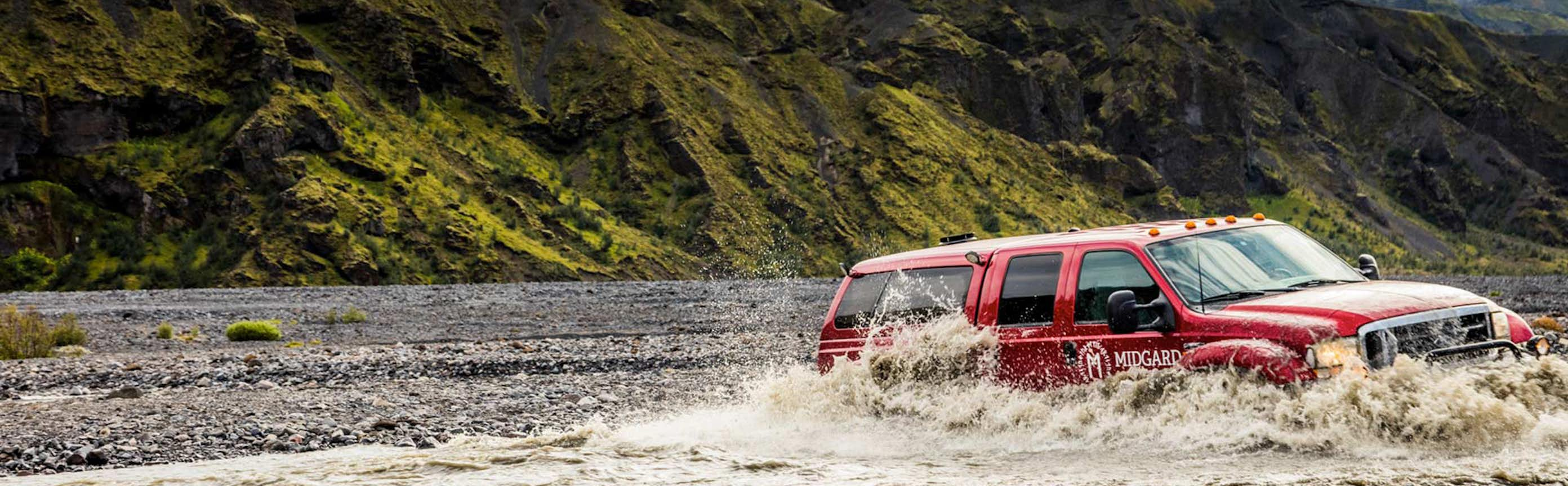
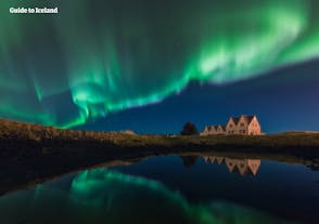
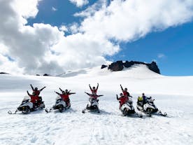
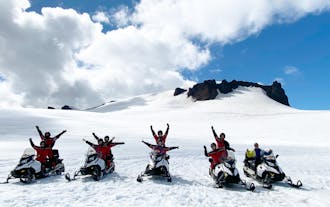
Super Jeeping in Iceland
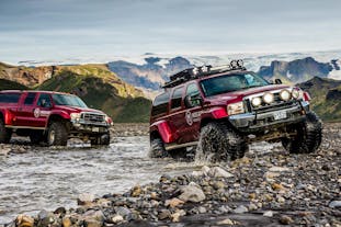
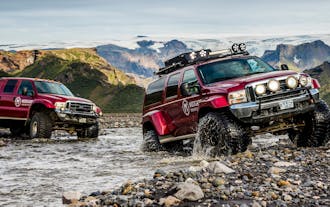
Since the introduction of the Jeep Wrangler to Iceland, there has been an all-out national obsession with jeeps. The word for jeep in Icelandic is ‘jeppi’, and since jeeps first accompanied American soldiers to the island during World War 2, Icelanders have customised the vehicles to tackle the challenging terrain of their native land.
As opposed to other countries where highly modified jeeps or “monster trucks” are often intended for flashy ambitions, in Iceland, their value is far more utilitarian in nature.
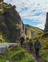
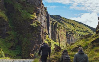
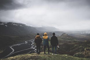
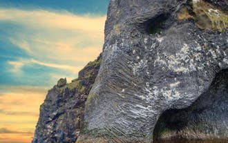
Super jeeps, or, ‘fjallajeppi’ (translating to ‘mountain jeeps’), are invaluable for reaching impossibly remote locations. In fact, it’s difficult to imagine a better way of exploring and engaging with the raw beauty of Iceland than bounding over magnificent landscapes in a super jeep.
Given the limited number of seats during super jeep tours, you are guaranteed a small, intimate group experience, allowing more time with your guide to educate you about the natural and cultural landmarks you encounter. The reduced number of people on these expeditions inevitably means less time wasted waiting for larger numbers to regroup, maximizing your time enjoying attractions.
Road and weather conditions in Iceland can, at times, be daunting, so why not relax and enjoy a super jeep tour that promises a breathtaking ride. Don’t miss your chance to travel in style and book a super jeep tour today!
Frequently asked questions
What is a super jeep?
What is the best super jeep tour in Iceland?
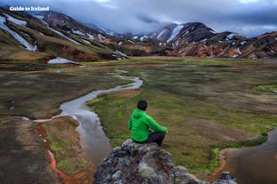
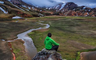
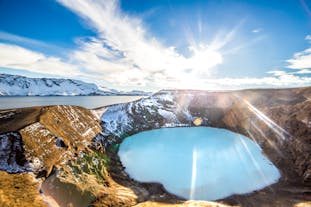
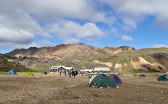
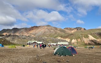
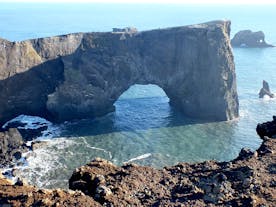
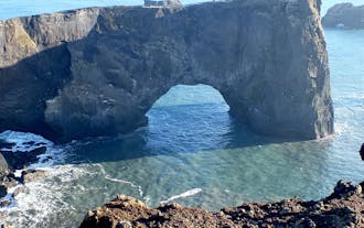
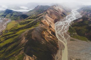
Another highly rated tour is this Landmannalaugar super jeep tour with pickup from Reykjavik, rated 4.7 out of 5 stars by more than 110 travelers, and costs about 329 USD. Be captivated by the otherworldly beauty of Landmannalaugar and see waterfalls, craters, and rhyolite mountains onboard a super jeep.
Is it worth it to take a super jeep tour in Iceland?
What is the cheapest super jeep tour in Iceland?
Also among the cheap super jeep tours is this off-road two-hour super jeep sightseeing tour of the Streiti Coast with transfer from Breiddalsvik, which costs around 125 USD. Explore the backcountry of East Iceland on a super jeep and witness the beautifully diverse landscape of Iceland.
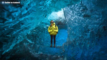
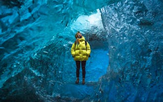
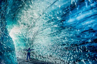
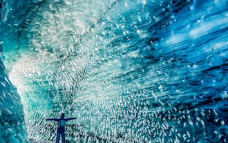
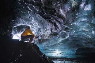
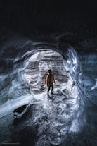
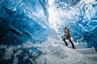
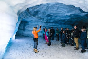
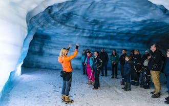
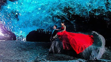
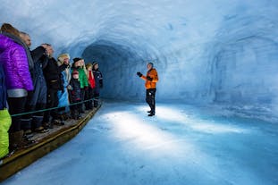
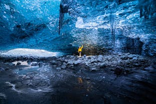
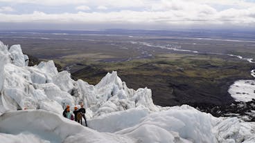
Another affordable tour is the guided 45-minute blue ice caving adventure in Vatnajokull with transfer from Jokulsarlon that costs around 143 USD. After a 30-minute off-road ride on a super jeep, you’ll reach Iceland’s largest glacier, Vatnajokull, where you’ll get to explore the enchanting blue ice cave.
Why should I choose a super jeep tour over a bus tour?
Why are super jeep tours more expensive than bus tours?
Will we drive off-road on a super jeep tour?
Isn’t crossing rivers in Iceland dangerous?
Do I get to drive the super jeep myself?
How many people are on a super jeep tour in Iceland?
Can I book a private super jeep tour and get a customised itinerary?
I am a solo traveller and there is a minimum of four participants for this tour. Can I join?
Can you put me on a waiting list for a super jeep tour in Iceland?


Download Iceland’s biggest travel marketplace to your phone to manage your entire trip in one place
Scan this QR code with your phone camera and press the link that appears to add Iceland’s biggest travel marketplace into your pocket. Enter your phone number or email address to receive an SMS or email with the download link.


