Best Jokulsarlon Tours in Iceland
Select starting location
Select dates
Add travelers
Jokulsarlon Tours
Refine the results by using the filters


Explore an unequalled wealth of tours and packages
Verified customer reviews
Read first-hand reviews by customers from across the world


Visiting Jokulsarlon
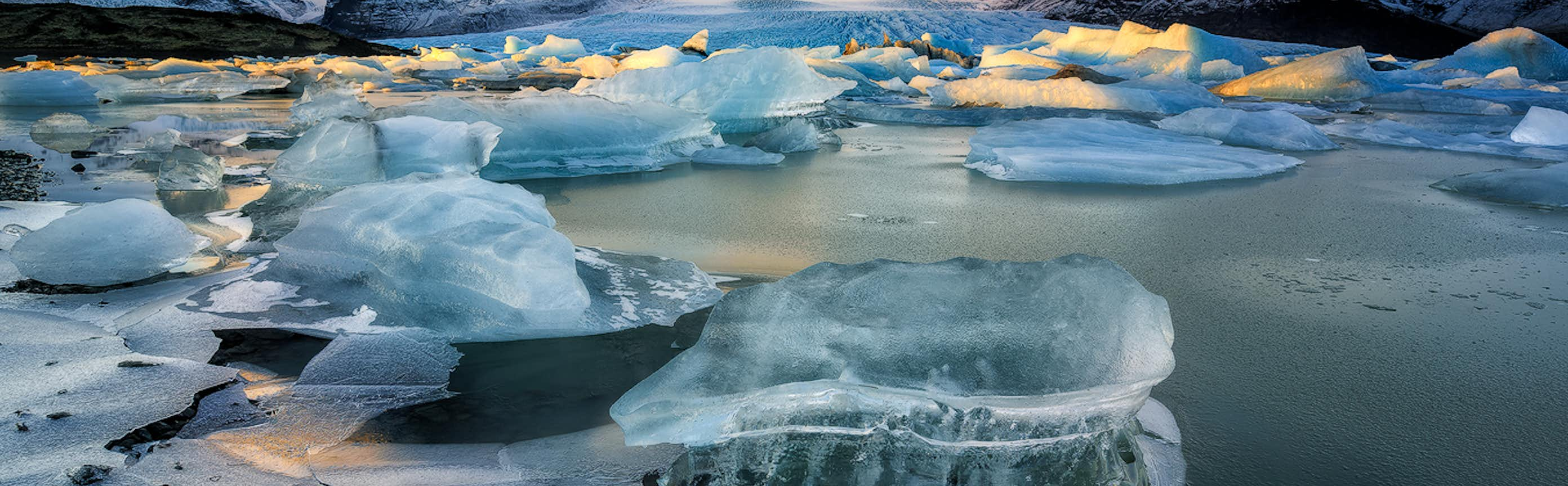
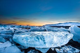
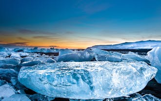
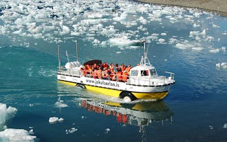
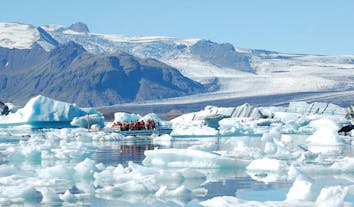
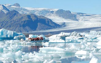
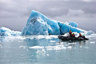
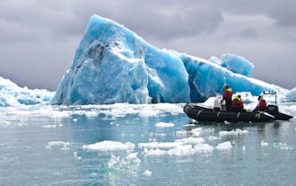
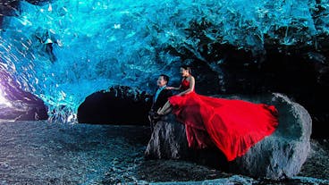
Jökulsárlón glacial lagoon is a stunning attraction that is always a favourite of visitors and locals. The lagoon is made up of a mixture of fresh water and sea water and iconic for the giant icebergs that dominate the landscape. Standing at up to 30-metres tall, the icebergs are cast in contrasting milky whites and fantastic electric icy blues.
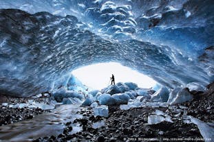
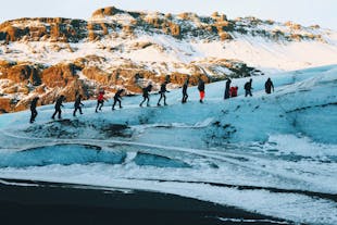
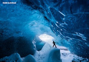
Breiðamerkurjökull glacier crawls forward with intimidating force and weight, collecting in its margins glacial deposits of black sand and gravel which make striking patterns on the ice and subsequent icebergs. As the glacier retreats, it continuously creates icebergs of over 1000-years old ice that are often patterned by ash from historical eruptions. No two iceberg are the same, and you could spend hours finding fascinating shapes with no end to photographic opportunities. However silly this sounds, please do not try to stand on the icebergs as it is extremely dangerous.
The lake started taking form around 1935 when the glacier began to recede due to warming temperatures and is now the deepest in Iceland at 248 m (814 ft). Over the last 15-years, the lake is said to have doubled in size, and it is predicted that as the glacier continues to recede, it will leave a dramatic fjord behind. Sadly, warming global temperatures and the shrinking of glaciers are especially visible and Iceland, providing only further impetus to catch these icy wonders while we can.
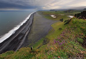
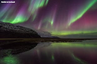
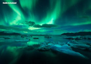
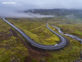
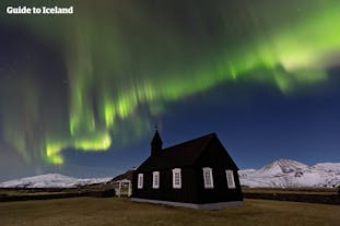
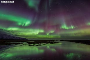
Jökulsárlón is conveniently located on the Highway 1 road between Skaftafell nature reserve and the picturesque town of Höfn. If you are driving the ring-road around Iceland, this is a stop you do not want to miss and a destination you will want to include if you are planning a visit to the South Coast. Many tour operators offer guided trips to the lagoon if you are not driving yourself, most often combined with other exciting attractions such as the waterfalls of South Iceland. If departing from Reykjavík in the winter, do consider how much you time you have, because although a fantastic destination for the northern lights, you may not want to drive all the way back to the capital in icy conditions in the dark.
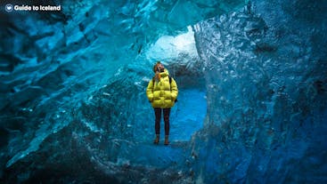
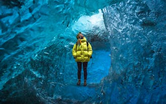
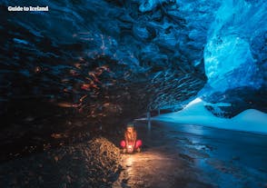
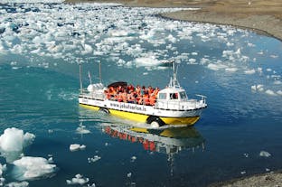
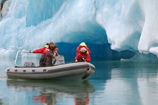
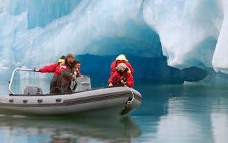
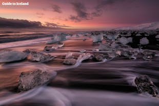
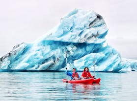
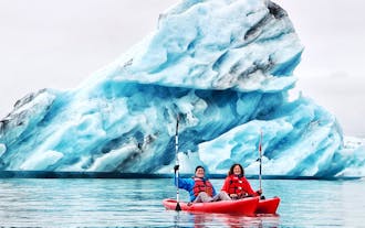
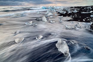
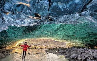
You can enjoy this wonder of Iceland from the shore or if you would like to get up close and personal with these ancient icy giants you can take a zodiac boat or amphibious boat tour guided by an expert. Around the corner is the legendary Diamond Beach where the icebergs sometimes wash up, glistening in the light in stark contrast to the black sandy beach they upon which they rest.
The golden hours of sunset and sunrise are exceptional times to witness this ethereal lake, especially if you are passionate about photography. Whatever time you visit, you can spend hours mesmerised by the luminous ice, and you could return several times and always be guaranteed a unique scene.
Jökulsárlón is appropriate for any age and budget and is a guaranteed unforgettable experience leaving you in no doubt of why it is called the Crown Jewel of Iceland.
Jökulsárlón has been used as a Hollywood location for such movies as James Bond films A View to Kill and Die Another Day as well as Lara Croft Tomb Raider and has featured in popular US television show, The Amazing Race. It is easy to understand why as the serene procession of ice is hypnotising and the plentiful wildlife of seals and birds only adds to the wonder.
Frequently asked questions
When is the best time to visit Jokulsarlon glacier lagoon in Iceland?
What activities can I partake in around Jokulsarlon glacier lagoon in Iceland?
How long does it take to drive to Jokulsarlon from Reykjavik?
What is the Diamond Beach in Iceland?
What accommodation is available near Jokulsarlon glacier lagoon in Iceland?
Can I take a boat tour on the Jokulsarlon glacier lagoon?
What should I wear for a visit to Jokulsarlon?
Is Jokulsarlon crowded?
Is the glacier lagoon in Iceland worth it?
How long do you need at Jokulsarlon glacier lagoon in Iceland?
Can I reach Jokulsarlon in a normal car or do I need a 4WD?
How was Jokulsarlon glacier lagoon formed?
Do any animals live in Jokulsarlon glacier lagoon?
Can I swim in the Jokulsarlon glacier lagoon?
Is there a café or any food options close to Jokulsarlon glacier lagoon?
Is it possible to visit Jokulsarlon glacier lagoon as a day trip from Reykjavik?


Download Iceland’s biggest travel marketplace to your phone to manage your entire trip in one place
Scan this QR code with your phone camera and press the link that appears to add Iceland’s biggest travel marketplace into your pocket. Enter your phone number or email address to receive an SMS or email with the download link.


