Best Snowmobile Tours in Iceland — Largest Selection & Cheapest Prices Guaranteed
Choose your perfect Icelandic experience
Select dates
Add travelers
Snowmobile Tours
Refine the results by using the filters
Explore an unequalled wealth of tours and packages


Verified customer reviews
Read first-hand reviews by customers from across the world


Everything you need to know about snowmobiling in Iceland
Snowmobiling in Iceland is an exhilarating way to explore the country’s vast glaciers, offering breathtaking views of snow-covered landscapes and towering mountains. Whether you're an adrenaline seeker or a nature lover, this adventure allows you to access remote areas that would otherwise be unreachable.
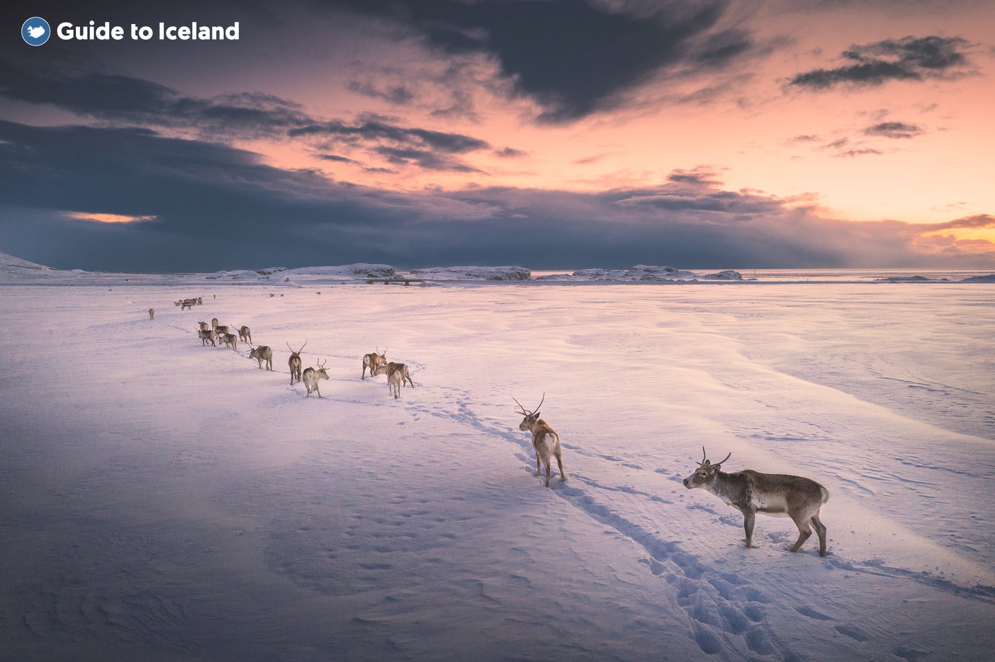
Iceland is home to some of Europe’s largest glaciers, covering about 11% of the country’s landmass. Popular snowmobiling locations include Langjokull, known for its vast open snowfields and ice caves; Vatnajokull, the largest glacier in Europe; and Myrdalsjokull, which sits above the active Katla volcano and offers dramatic scenery. Snowmobiles, equipped with rubber tracks and skis, provide a smooth and thrilling ride across these icy terrains, making them a popular way to explore Iceland’s frozen landscapes.
With expert guides leading the way, snowmobiling is suitable for all skill levels, making it an unforgettable experience for both beginners and experienced riders. Whether you’re racing across the ice or pausing to take in the silence of the Arctic wilderness, snowmobiling in Iceland is a must-do adventure that blends adrenaline with the country’s raw natural beauty.
Best Snowmobile Tours from Reykjavik
Maximize your time in Iceland by combining a thrilling snowmobile ride with visits to the country’s most famous sites. Many guided tours from Reykjavik pair snowmobiling with the Golden Circle, ice cave exploration, or geothermal hot springs, giving you a chance to experience multiple bucket-list adventures in a single day.
-
Golden Circle & Snowmobiling Tour: Experience Iceland's iconic Golden Circle—Thingvellir National Park, Geysir geothermal area, and Gullfoss waterfall—culminating in an exhilarating snowmobile ride on Langjokull glacier.
-
10-Hour Super Jeep Tour of Langjokull with Snowmobiling & Secret Lagoon: Embark on a thrilling Super Jeep adventure across Langjokull glacier, enjoy a snowmobile excursion, and unwind in the soothing waters of the Secret Lagoon geothermal pool.
-
Golden Circle Day Tour with Snowmobiling Experience to Langjokull Ice Cave: Combine a classic Golden Circle tour with an exciting snowmobile journey to a mesmerizing ice cave within Langjokull glacier.
-
Private Full-Day South Coast Tour with Optional Snowmobiling on Eyjafjallajokull Volcano: Explore Iceland's stunning South Coast, including Seljalandsfoss and Skogafoss waterfalls, with the option to add a thrilling snowmobile adventure on the Eyjafjallajokull glacier.
-
Snowmobile Tour and Into the Glacier on Langjokull: Experience the thrill of snowmobiling on Langjokull glacier and venture into the largest man-made ice tunnel in the world for a unique subterranean adventure.
Top Langjokull Glacier Snowmobile Tours
Langjokull glacier is one of the best places in Iceland for an unforgettable snowmobiling adventure, offering vast snowfields and breathtaking views. Most tours to this stunning ice cap begin at Gullfoss waterfall, a key stop on the Golden Circle, making it easy to combine with other must-see attractions. Located about 1 hour and 45 minutes from Reykjavik by car, these tours provide a perfect mix of adventure and sightseeing, allowing you to experience the thrill of racing across the glacier while exploring one of Iceland’s most iconic regions.
-
Snowmobile Tour from Gullfoss: Embark on an exhilarating snowmobile adventure atop Langjokull glacier, starting from the iconic Gullfoss waterfall.
-
Ice Cave and Snowmobile Tour: Combine the thrill of snowmobiling on Langjokull glacier with an exploration of a mesmerizing natural ice cave.
-
Glacier Rush — Fast-Paced Snowmobile Tour: Experience an adrenaline-pumping, fast-paced snowmobile ride across the snowy expanse of Langjokull glacier.
Top South Coast Snowmobile Tours
Iceland’s South Coast is home to some of the most breathtaking scenery in the country, and snowmobiling is one of the best ways to experience its unique glaciers up close. From the towering ice fields to dramatic views over black sand beaches and volcanoes, these tours offer a unique perspective on Iceland’s ever-changing landscapes.
-
Snowmobiling & Super Jeep Tour on Vatnajokull Glacier: Embark on a thrilling snowmobile adventure atop Europe's largest glacier, Vatnajokull, accessible via a Super Jeep journey from Hofn.
-
Glacier Snowmobiling Tour on Myrdalsjokull Glacier: Experience the exhilaration of snowmobiling on Myrdalsjokull glacier, with panoramic views over Iceland's South Coast and the chance to explore the ice cap above the Katla volcano.
-
Snowmobiling Tour on Eyjafjallajokull Glacier: Join a guided snowmobile tour on the iconic Eyjafjallajokull glacier, combining adventure with breathtaking vistas of the surrounding landscapes.
-
Snowmobiling Tour on Vatnajokull Glacier: Whizz across the stunning snowscapes of Vatnajokull glacier on a snowmobile, starting from Smyrlabjorg, and immerse yourself in the beauty of Europe's largest glacier.
Top Road Trips and Vacation Packages with Snowmobile Excursions
Exploring Iceland by road offers the ultimate freedom to discover its breathtaking landscapes at your own pace, and adding a snowmobile excursion takes the adventure to the next level. Whether you're embarking on a multi-day self-drive tour or booking a guided vacation package, these trips combine scenic drives with the thrill of racing across glaciers.
-
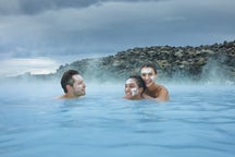
5-Day Northern Lights Winter Vacation Package with Ice Caving & the Blue Lagoon: Embark on a five-day winter adventure featuring northern lights hunting, glacier hiking, and a visit to a natural blue ice cave in Vatnajokull National Park, complemented by relaxation at the Blue Lagoon.
-
10-Day Self-Drive Tour of the Complete Ring Road: Explore Iceland's diverse landscapes at your own pace on this ten-day self-drive journey around the Ring Road and Snaefellsnes peninsula, visiting iconic sites like the Golden Circle, Jokulsarlon glacier lagoon, and Akureyri.
-
1-week Summer Self-Drive Tour of the Ring Road: Experience the best of Iceland in eight days with this self-drive tour, covering the Ring Road and Golden Circle, and discover natural wonders such as waterfalls, volcanoes, and charming coastal towns.
-
7-Day Northern Lights Self-Drive Tour Through South Iceland: Immerse yourself in Iceland's winter beauty on a seven-day self-drive tour, combining the Golden Circle and South Coast highlights with opportunities to witness the mesmerizing northern lights.
What to Expect When Snowmobiling in Iceland
Snowmobiling tours in Iceland are well-organized adventures that provide a seamless blend of excitement and safety. Before setting off, participants receive a full safety briefing and instructions on how to operate the snowmobiles, ensuring that even first-time riders feel comfortable. All necessary gear is provided, including insulated overalls, helmets, gloves, and goggles, so you can stay warm and protected against the elements.
Once on the ice, riders can expect a mix of steady cruising and exhilarating bursts of speed, with some snowmobiles reaching up to 44 mph (70 km/h). While no prior experience is required, drivers must be at least 18 years old with a valid license, and passengers must be at least six years old (check the booking details of your preferred tour for specific age requirements). Sturdy hiking boots and layered clothing are recommended for added comfort. It’s also important to note that Icelandic driving laws apply—there is zero tolerance for alcohol consumption before or during the ride.
A Thrilling Adventure in Iceland’s Frozen Wilderness
Snowmobiling in Iceland is more than just an adrenaline rush—it’s an opportunity to witness the country’s breathtaking glaciers from a unique and exhilarating perspective. Whether gliding across Langjokull’s endless snowfields, exploring the icy landscapes of Vatnajokull, or taking in the volcanic contrasts of Myrdalsjokull, this adventure offers an unforgettable way to connect with Iceland’s raw and untamed beauty. With expert guides leading the way, you’ll have plenty of opportunities to pause and take in sweeping panoramic views, capturing stunning photos of the vast, snow-covered landscapes that make Iceland so extraordinary.

Download Iceland’s biggest travel marketplace to your phone to manage your entire trip in one place
Scan this QR code with your phone camera and press the link that appears to add Iceland’s biggest travel marketplace into your pocket. Enter your phone number or email address to receive an SMS or email with the download link.