Best Sightseeing Tours in Iceland
Select starting location
Select dates
Add travelers
Sightseeing Tours
Refine the results by using the filters


Explore an unequalled wealth of tours and packages
Verified customer reviews
Read first-hand reviews by customers from across the world


Sightseeing in Iceland
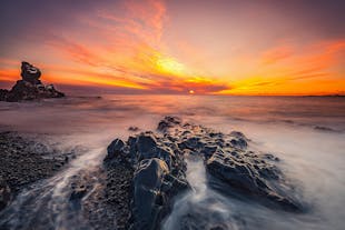
Sightseeing in Iceland offers travellers a unique plateau of geological features, from domineering mountainscapes to carved and crooked coastlines.
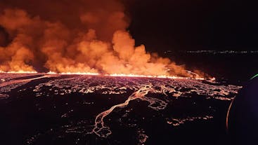
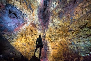
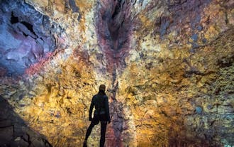
Iceland’s formation started about 18 million years ago, as lava rising from the Mid-Atlantic Ridge, then cooling on the ocean’s surface. This process continues today. The primordial energy that shaped the land seen today is often exposed at the surface, with geothermal areas and hot springs dotting the country.
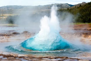
This intense mixture of the elements has produced many other natural features, including fumaroles, geysers and bubbling mud puddles, providing the unique chance to see, and smell, the earth as it jostles and moves under heat and pressure.
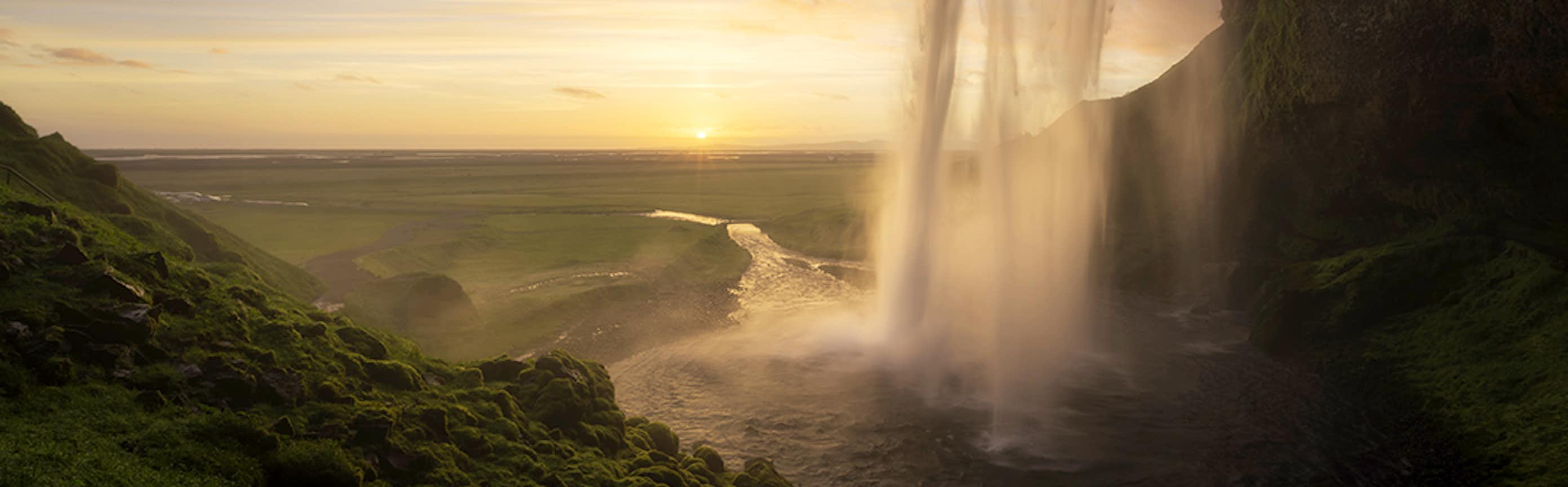
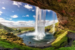
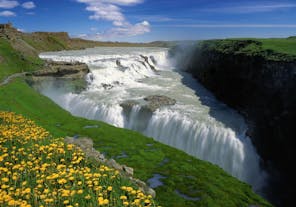
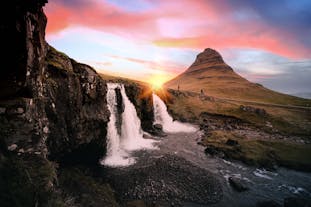
Water is a central feature of Iceland’s scenery, having long sculpted the island with huge carving glaciers, heavy rainfall, crashing Atlantic waves and flowing rivers. Waterfalls are prolific, whether they are gentle trickles emerging from lava plateaus or thundering cascades plummeting from the interior highlands; there are simply too many to count, and they make up an integral part of any sightseeing route around the country.
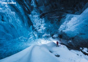
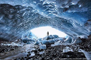
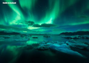
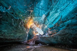
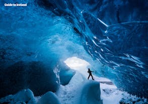
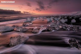
Ice dominates much of the landscape, with glaciers covering 11% of the island. Visitors can admire these glaciers from a distance or take the opportunity to see them up close. The spaces these glaciers leave behind create dramatic fjords, now an iconic feature of the Icelandic coastline.
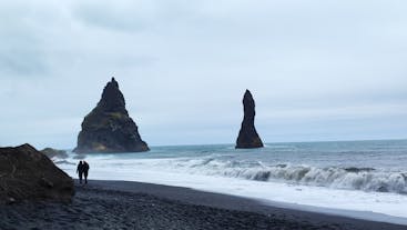
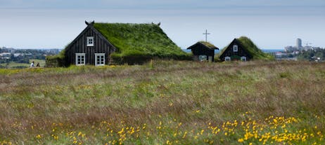
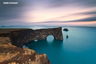
Fantastic rock formations are plentiful and varied. From erupting sea-stacks to basalt columns, there’s no end of wonder to gaze upon. Dramatic lava fields cover much of the surface of this ancient land and are often covered with thick moss.
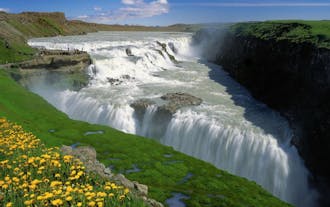
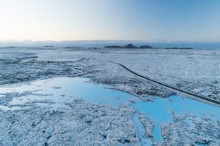
Travellers to Iceland will always find something new, as the countryside transforms dramatically with each season. Grand waterfalls, accented with rainbows, are a staple sight in the summer but become ice-riddled behemoths in the winter time.
No matter where or when you choose to embark on a sightseeing tour, you’re promised a unique and memorable experience, not to mention countless subjects to feast your camera lens upon.
Frequently asked questions
What is the best sightseeing tour in Iceland?
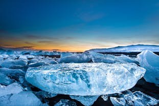
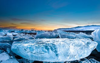
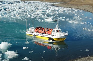
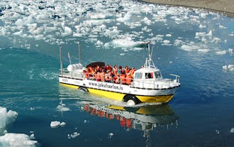
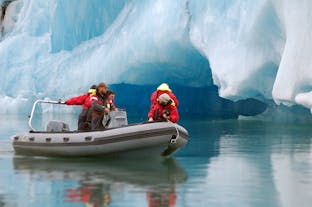
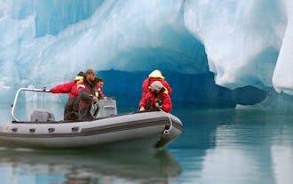
Another highly rated tour is this one-hour zodiac boat tour of Jokulsarlon glacier lagoon, given a rating of 4.9 out of 5 stars with over 390 reviews. Aboard a boat, you’ll get up close to the massive and impressive icebergs that float in Jokulsarlon glacier lagoon. In good weather, you also have the chance to see gulls and seals playing on ice.
What is the cheapest sightseeing tour in Iceland?
For those interested in getting around Reykjavik, take this hop-on hop-off bus tour that costs around 36 USD. Tour the city at your leisure as you hop on and hop off the cherry-red city sightseeing bus. This is an efficient way to see the several attractions that Reykjavik has to offer.
You may also avail of the Reykjavik city card | 72 Hours which costs about 59 USD. This card gives you free access to the city museums and galleries, as well as public transport, geothermal pools, the Reykjavik Family Park and Zoo, and more.
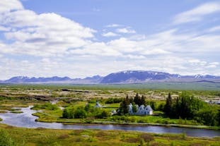
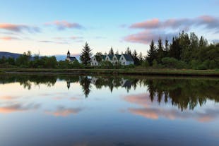
What are the major attractions on the Golden Circle sightseeing route in Iceland?
What are the major attractions on the South Coast of Iceland?
What are the major attractions on the Diamond Circle sightseeing route in Iceland?
How long will guests have at each attraction when sightseeing in Iceland?
Is lunch included?
What time of the year do the sightseeing tours operate?
Which language will our tour guide speak?
Will I be able to be picked up and dropped off at my accommodation in Iceland?
Can I sign up for a sightseeing tour in Iceland if I am a solo traveller?
What type of vehicle is used on a sightseeing tour in Iceland?


Download Iceland’s biggest travel marketplace to your phone to manage your entire trip in one place
Scan this QR code with your phone camera and press the link that appears to add Iceland’s biggest travel marketplace into your pocket. Enter your phone number or email address to receive an SMS or email with the download link.


