Best Glacier Tours in Iceland
Select starting location
Select dates
Add travelers
Glacier Tours
Refine the results by using the filters


Explore an unequalled wealth of tours and packages
Verified customer reviews
Read first-hand reviews by customers from across the world


Exploring Glacier Tours in Iceland
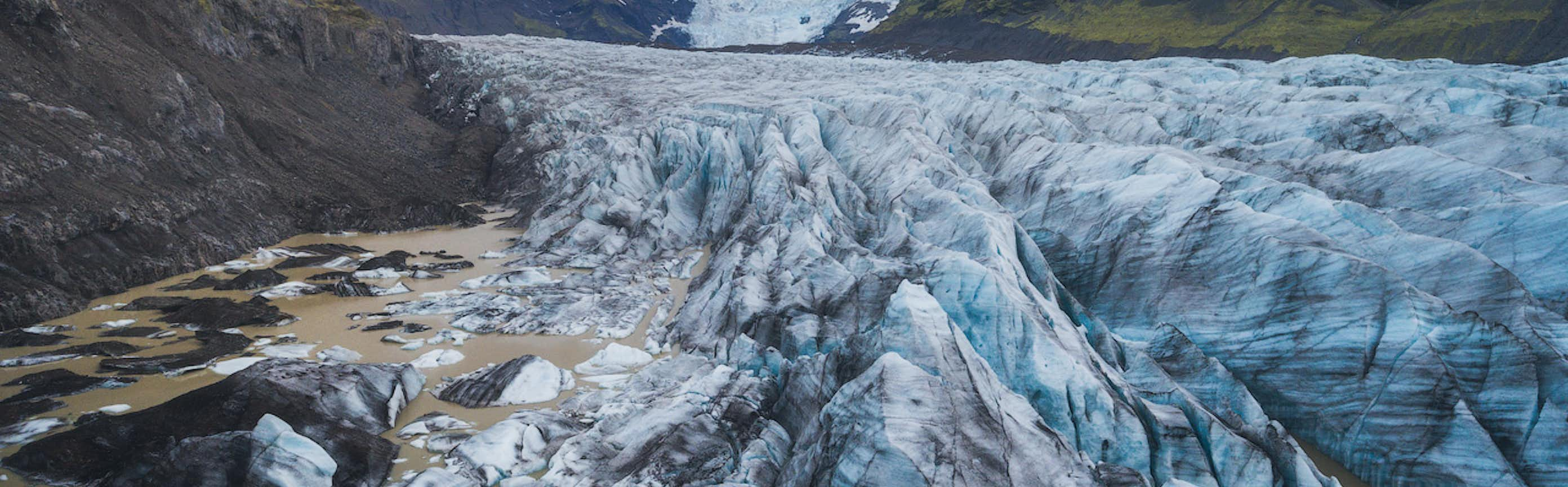
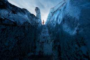
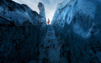
Embark on a mesmerizing journey with glacier tours in Iceland, where the frozen landscapes unfold in breathtaking beauty. As you venture into this Arctic wonderland, you'll witness nature's grandeur at its most magnificent.
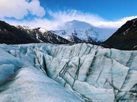
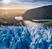
The tours offer a unique opportunity to explore Iceland's awe-inspiring glaciers, such as Vatnajokull, the largest ice cap in Europe, and Snaefellsjokull, an iconic stratovolcano-capped glacier.
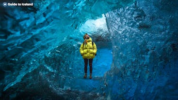
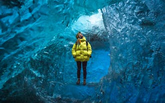
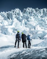
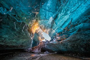
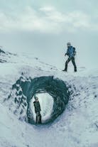
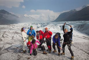
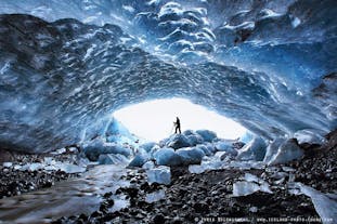
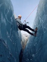
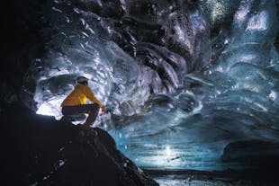
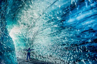
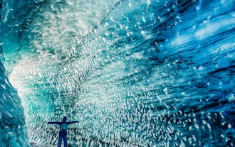
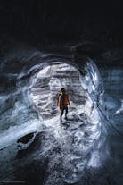
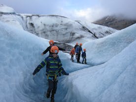
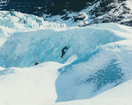
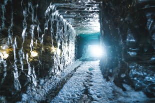
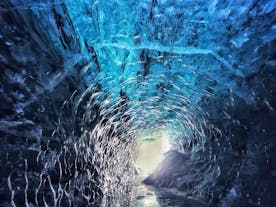
Guided by seasoned experts, visitors delve into the heart of these icy giants, discovering ancient crevasses, towering ice formations, and crystal-clear blue ice caves. The tours seamlessly blend adventure with environmental stewardship, emphasizing the importance of preserving these fragile ecosystems. Adventurers can partake in exhilarating activities like glacier hiking and ice climbing, enhancing the immersive experience.
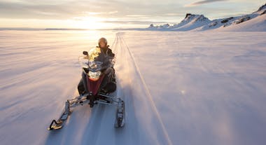
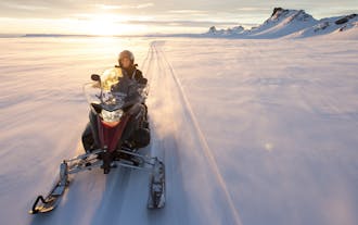
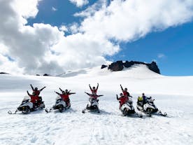
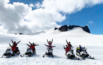
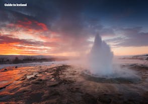
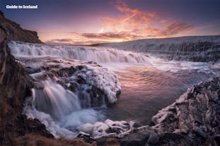
Beyond the frozen expanses, glacier tours provide a front-row seat to Iceland's diverse wildlife and stunning vistas. From the serenity of glacial lagoons to the thunderous roar of ice calving into the ocean, each moment is a testament to the raw power and delicate balance of nature in this Arctic realm.
Whether you're an intrepid explorer or a nature enthusiast, these tours promise an adventure of a lifetime, leaving you with unforgettable memories of Iceland's enchanting glaciers.
Frequently asked questions
What is the best glacier tour in Iceland?
This tour costs around 143 USD.
Another highly rated tour is this three-day northern lights tour of Iceland’s Golden Circle & South Coast with ice caving & glacier hiking, given a rating of 4.8 out of 5 stars with more than 910 reviews. This tour not only brings you to iconic Icelandic landscapes but also lets you explore glaciers and landscapes. This adventure is approximately 964 USD.
Is it worth it to take a glacier tour in Iceland?
Whether exploring ice caves, marveling at colossal ice formations, or learning about the geological wonders from knowledgeable guides, the adventure promises unforgettable memories and a deep connection with the pristine Arctic environment.
What is the cheapest glacier tour in Iceland?
Another very affordable tour is this best price Solheimajokull glacier hiking tour, which is around 97 USD. This tour starts at the foot of Solheimajokull, brings you to impressive ice formations, and lets you drink glacial water.
Can I go on a glacier hike by myself in Iceland, or do I need a tour?
What is there to see on top of a glacier in Iceland?
How long do glacier hiking tours in Iceland typically last?
What is the average group size for glacier hiking tours in Iceland?
What should I wear for glacier hiking tours in Iceland?
Can the elderly join glacier hiking tours in Iceland?
What glaciers are popular for hiking tours in Iceland?
Where is Skaftafell Nature Reserve in Iceland?
What is the difference between glacier tours onto Svinafellsjokull glacier and onto Solheimajokull glacier?
Icelandic weather can be unpredictable. Will my glacier walk be cancelled if it rains?
When is the best time for glacier hiking tours in Iceland?
Are glacier hiking tours suitable for beginners?
What equipment is needed for a glacier hiking tour in Iceland?
Are there any age or fitness restrictions for glacier hiking tours in Iceland?
Is it safe to go glacier hiking in Iceland?
Do I need to book a glacier hiking tour in Iceland in advance?


Download Iceland’s biggest travel marketplace to your phone to manage your entire trip in one place
Scan this QR code with your phone camera and press the link that appears to add Iceland’s biggest travel marketplace into your pocket. Enter your phone number or email address to receive an SMS or email with the download link.


